Michael Bushnell
Publisher
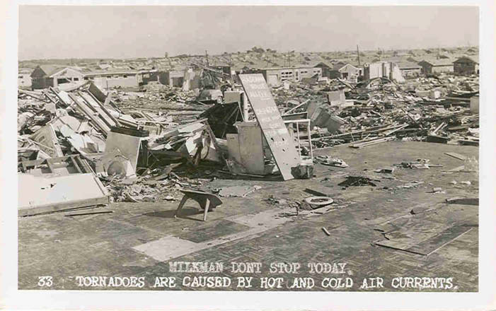
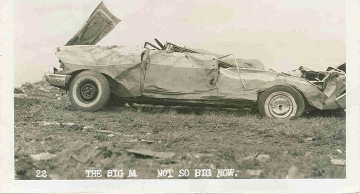
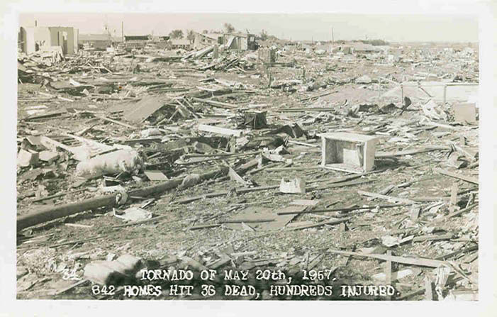
Sixty seven years ago this week, a string of savage storms rose from the southern plains states and tore a devastating path across the Kansas City area that some older residents won’t soon forget. This real photo postcard spotlights the damage from the May 20, 1957, Ruskin Heights tornado that carved a path of destruction from its touchdown in Williamsburg, Kan., to just north of Raytown, Mo., when the tornado spun itself back into the clouds. According to follow up weather notes, published in the June of 1957 edition of the Journal of the National Oceanic and Atmospheric Administration [NOAA], the twister followed largely a single path that varied from 1/10 of a mile wide to almost a half mile wide at its widest point. The length of the tornado’s path was listed as 71 statute miles. Great difficulty was noted in the duration of the storm because upon touchdown, all of the clocks stopped. The NOAA estimates that touchdown first occurred at roughly 18:15 hours (6:15 p.m.) and stayed on the ground for the next 98 minutes traveling a total of between 68 and 71 miles, averaging 41.6 miles per hour with sustained winds at over 270 miles per hour.
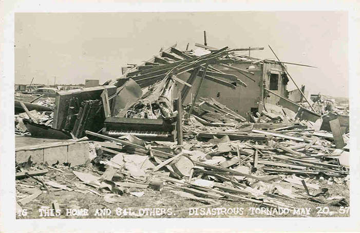
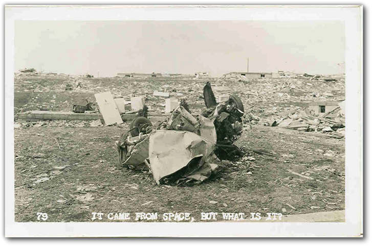
By the time the all-clear had sounded from the newly-formed National Weather Bureau, 44 people had been killed, hundreds suffered injuries on both sides of the state line and more than 600 homes lay in ruin from the storm’s path. Debris from the storm fell as far away as 10 miles to the north of the storm’s path and was carried as high as 30,000 feet.
From a meteorological standpoint, the conditions were ripe on that day for super-cell thunderstorm development. According to the National Weather Service, which maintains a web page specifically dedicated to the storm systems that spawned the Ruskin Heights tornado, more than 50 tornadoes formed that day as a result of a low pressure system centered over central Nebraska that combined with a high level storm system coming off the Colorado Rockies. Cool, moist air from the Gulf of Mexico further intensified the storm system. The first tornado touched down a little after 11 a.m., just north of Goodland in far western Kansas.
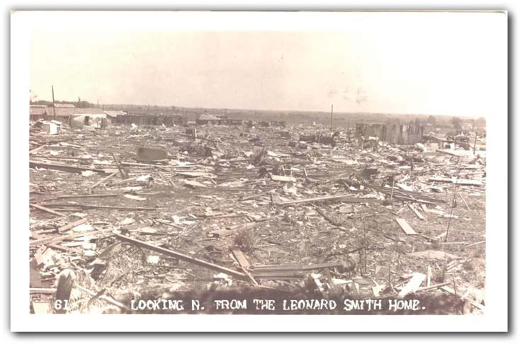
In the months following the storm, Ruskin Heights residents mostly rebuilt and moved on with their lives. For years following the tornado, some residents were still alarmed by the passing of the Missouri Pacific freight trains, the line running north and south along Blue Ridge Boulevard. Engineers often blew their whistle as they passed, so residents could tell the loud roar was a train and not another tornado funnel. A memorial to those who lost their lives was dedicated one year after the storm and still stands as a testament today near 87th Street and Blue Ridge Boulevard.
The personal message on the back of the card reads: “Houses used to stand where all this rubble is. 800 were destroyed. Dear Helen, Having a wonderful time here. A little warm but house is air conditioned. (103) We go swimming at the country club almost every day to cool off. Went shopping at Macy’s etc. and bought two dresses. Saw the play Pajama Game. Steaks grilled outdoors tonight. Mary Wischnact.”
The description on the front of this postcard says the view is “Milkman don’t stop today.” The propped up hand lettered board notes that the Hagemann family is ok, listing their phone number. Note the two milk bottles placed neatly at what was once the curb. The phone number listed on the board is still a working number but no longer belongs to the Hagemann family. The card was sent to Mrs. Helen Miller, 172 Louvane Drive, Kenmore N.Y. on Aug. 2, 1957, a little over 60 days after the storm hit.
If you’d like additional information about the Ruskin Heights Tornado, visit: http://weather.gov/eax/RuskinHeights For some very detailed information and meteorologic notes on the Ruskin Heights tornado.


