By Michael Bushnell
Northeast News
June 3, 2015
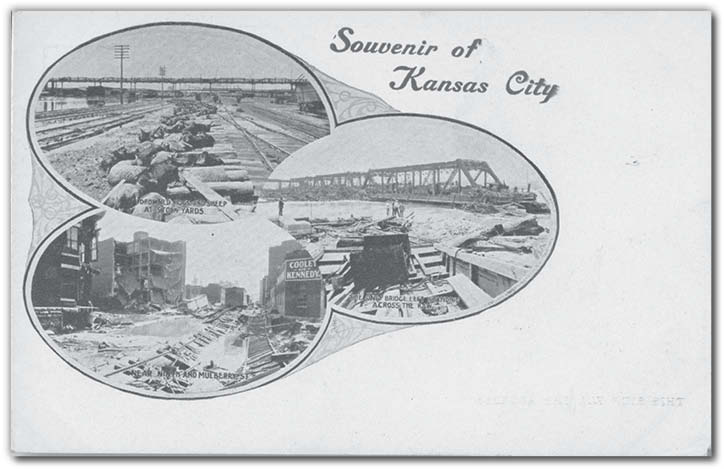
As we approach the rainy summer season, it is fitting that we run a postcard showing three scenes from the West Bottoms area immediately following the great flood of 1908.
One description of the flood was written in a booklet published after the flood waters receded by the Novelty Postcard Company of Kansas City.
“The heavy rains during the month of June in the Missouri and Kaw River valleys was the cause of a flood which almost equaled the flood of June 1903. The rise reached the height of 29.07 feet in the Kaw River and 32.03 feet in the Missouri River. The immense drift built a dam at the Missouri Pacific Railroad Bridge, which forced the water to back up in all the sewers and drainage-ways of the two Kansas Cities and flooded the lowlands in Armourdale and Argentine as well as the West Bottoms. The water reached a depth of two to 10 feet in these districts. Business interests were temporarily suspended and homes abandoned. No lives were lost but the damage to property, both real and personal, has reached at least a million.”
After the flood of 1908, city leaders drew up plans to move Union Depot from the often-flooded West Bottoms to a higher location. A location in a large gully near Signboard Hill was chosen and plans were set into motion to build a new train station, the likes of which would rival the great depots of Chicago and New York. Union Station opened seven years later, on what is now called Pershing Road.