Michael Bushnell
Publisher
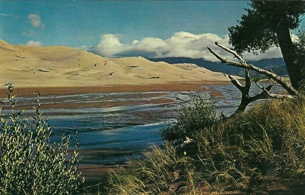
Nestled in a valley just to the north of Colorado’s Sangre de Cristo mountain range in Southern Colorado on the eastern edge of the San Luis Valley lies the Great Sand Dunes National Park and Preserve, a 232-square-mile anomaly that is home to America’s tallest sand dunes in a protected setting.
Great Sand Dunes National Monument was originally established by President Herbert Hoover on March 17, 1932, protecting roughly 35,000 acres of dunes. On November 22, 2000 however, the area was re-designated as a National Park when over 120,000 additional acres were added to its footprint. The preserve protects an additional 49,000 acres on top of the park’s acreage.
The dune fields were formed by sediments blown into a glacial lake that once existed on the floor of the valley. Over a period of thousands of years, the lake receded and the prevailing winds exposed the sand and created the dunes and creating four unique ecosystems in the process.
The San Luis Valley where the Great Sand Dunes are located was once home to the Ute Tribe and traces of habitation date back almost 11,000 years. BY the late 1700’s, Spanish explorers, specifically the Spanish Governor of Santa Fe de Nuevo Mexico became the first recorded European to navigate the San Luis Valley.
English explorers Zebulon Pike, John “Frontier” Fremont and John Gunnison for whom Black Canyon and Gunnison Colorado is named all recorded treks through the area during the 18th and 19 century. In 2019, Great Sand Dunes National Park recorded a little over 515,000 visitors.
This Chrome era postcard was published in the late 1950’s or early 1960’s by Al Cole of Creede, Colorado. The printed description on the back of the card reads: “Situated in the San Luis Valley in south-central Colorado may be found these incredible dunes. The waters of Medano Creek flows only at intervals. The area is preserved for the American People by the National Park Service.” It has not been mailed.