
Northeast News
March 11, 2011
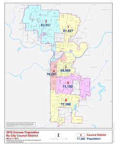
This week the City of Kansas City Council released the newly drawn council district maps based on the 2010 U.S. Census results. Northeast has been carved up once again with boundaries that slice through the heart of some neighborhoods. What do you think of the new lines? What would you like your newly elected city council representatives to know about the new boundaries? Tell us on Facebook at Kansas City’s Northeast News.