
Lily Bohlke, Missouri News Service
With congressional voting district maps finally in place in Missouri, county clerks are working to educate voters on the changes.
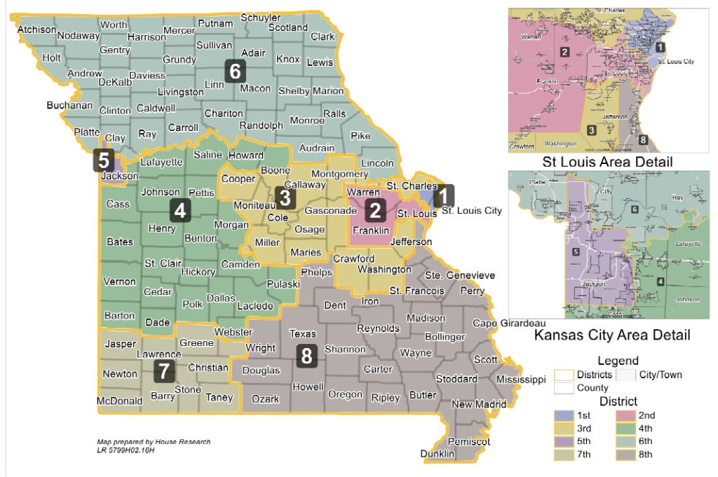
Every 10 years after the census is conducted, the state’s voting maps are redrawn.
Brianna Lennon, county clerk in Boone County, said it is important to make sure residents know what candidates and issues they can expect to see on their ballot for the August primary, and then the general election in November.
“They may be in a different district now than they were in the previous maps from 2010,” Lennon pointed out. “And that’s true, whether we’re talking about congressional maps or our State House and State Senate maps.”
Lennon pointed out county clerks across the state are facing a quick turnaround. The deadline for clerks to have changes made in the statewide voter registration database is next Tuesday, May 24. She added everything must be ready before absentee voting begins for military and overseas voters in June.
In the map, multiple counties are split into two districts, including Boone County. Lennon noted Boone County is split through Columbia’s downtown. Columbia voters tend to lean Democratic, while the surrounding areas lean Republican.
“The most important thing is making sure that voters are aware that the split exists,” Lennon emphasized. “We have the congressional map already up as an interactive map on our website, so that people can type in their address and see which district they will live in now. “
Missouri was the last state in the nation to send its congressional map to the governor’s desk. The final draft contains six districts likely to lean Republican and two likely to lean Democrat. Some more conservative GOP lawmakers had wanted seven districts to lean Republican, but the compromise map was passed after nearly five months’ delay.