Michael Bushnell
Northeast News
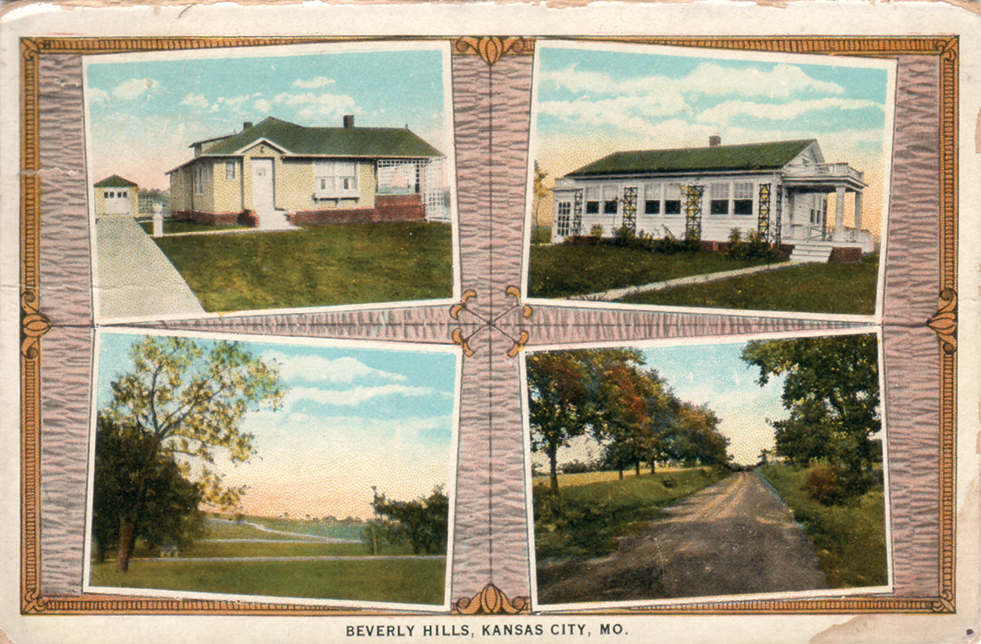
“Beverly Hills Acre Tracts. Ideal home sites on easy terms. City conveniences, no city or special taxes, half-acre lots at the price of city lots.”
So reads the marketing description on the back of this promotional postcard, published by the Curt Teich Co. in Chicago. It continues: “Beautiful location, city water, electricity, sewage disposal; paved and oiled streets; facing nearly a mile on paved highway. Short walk to splendid car service, free city schools, stores, churches, motor roads in all directions with connections to Washington Park Boulevard, 15th Street, Independence Road, Blue Ridge Boulevard, Swope Park, etc. Marketed by Earl C. Hallar Real Estate, 210 E. 10th Street, Harrison 3931.”
A review of the Tuttle-Ayers maps in the Missouri Valley Room at the Kansas City Public Library shows the Beverly Hills subdivision between the city limits of Kansas City and Independence, Mo.
The wedge-shaped addition fronts on what was then known as “Independence and Raytown Road” or as we know it today, Crysler (pronounced Kris-ler) Avenue. Bounded by 33rd Street on the south, 27th Street on the north and by the meandering Santa Fe Road on the east, the development began to take shape in 1926 and at the time was surrounded by farmland and railroad property. There are no signs off Crysler to denote the subdivision, but most of the homes that originally were built still stand, although modified or added on to. The card was sent to Mr. Harry H. Dolan at 427 Hardesty, right here in Historic Northeast.


