Michael Bushnell
Publisher
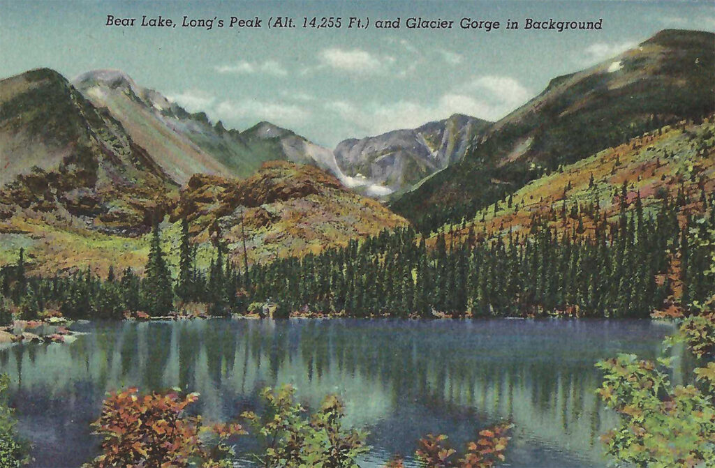
This week, we visit the top of the world in terms of National Parks in the lower 48 United States. Part of a Linen era postcard folder published by the Curt Teich Company of Chicago, Illinois, we trek to Bear Lake and the stunning vista of Long’s Peak in Rocky Mountain National Park.
Situated roughly forty miles almost due west of Loveland, RMNP as it is known in Parks parlance is home to more mountain peaks over 12,000 feet than any other park in the system. The park is also home to Trail Ridge Road, the highest paved road in the country, climbing to over 12,183 feet above sea level. For the more adventurous types, there’s the Fall River Road, the unpaved, original route to the summit of Fall River Pass. Due to its stunning mountain vistas, unimproved surface and stark lack of protective guardrails, it has been nicknamed the “oh-my-God” Road.
The park is also home to the headwaters of the Colorado River in the Northwest portion of the park, near Poudre Pass, just west of Long Draw Reservoir.
One interesting anomaly found in the park is where the Continental Divide forms a horseshoe shaped bend near the Never Summer Mountains. The bend allows streams on the eastern part of the slopes to join the headwaters of the Colorado River and flow toward the Pacific Ocean. In the same area but on the western slope of the bend, streams join rivers such as the Cashe LaPoudre River that flow north, east then south, eventually flowing into the Atlantic Ocean.
This view in the postcard folder shows Bear Lake and Long’s Peak with the glacial gorge as a scenic backdrop. Bear Lake is one of the highest elevated lakes in the park at just over 9400 feet above sea level. While not visible on the postcard, the lake borders the Continental Divide, Hallet Peak and the 14,259 foot Long’s Peak named for explorer Stephen H. Long who is said to have been the first White explorer to see and record his visit to the Front Range of the Rockies in 1820.
This postcard folder boasts over a dozen scenic views of Rocky Mountain National Park including Mt. Ypsilon, The Mummy Range, Iceberg Lake (el. 11,500 ft) and a number of views of the Rocky Mountain National Park Circle Trip route that leaves Denver westward on US 40, connecting with US 34 that traverses Fall River Pass, then East through Estes Park to Loveland, then back South along US 287 back to the Denver Metro. It is one of the most scenic drives along Colorado’s Northern Front Range.