 by Michael Bushnell
Northeast News
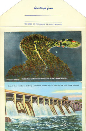
The description inside this vintage 1930s Curt Teich linen postcard folder of the Lake of the Ozarks reads, “Lake of the Ozarks is formed by a huge dam built across the Osage River near the town of Bagnall. The lake proper is 129 miles long, extending from the dam, upstream to about 35 miles above Warsaw and has a shore line of 1,300 miles and an area of 95 square miles. The inundated area covers land in Miller, Morgan, Camden and Benton Counties. These counties are approximately in the geographical center of Missouri. Bagnall Dam is approximately 138 miles west of St. Louis and 43 miles south of Jefferson City, the state capital and approximately 160 miles east of Kansas City.
“The Lake of the Ozarks region affords one of the greatest playgrounds in America. The Ozark Mountains fringe the shoreline and innumerable streams empty in to the great reservoir. Every sport associated with water, mountain or wood can be found. It is truly a sportsman’s paradise, the tired man’s retreat and the end of the artist’s dream.”
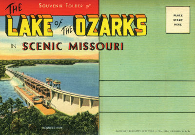
The folder contains 16 different views of Lake of the Ozarks, including Bagnall Dam, Drum Rock, Grand Glaize Bridge and an interesting aerial view of Duck Head Point.
Postcard folders came into style during the 1930s as an inexpensive way to send a variety of postcards of a single locale to friends and relatives back home. Although some postcard folders were perforated between card views, most were not, allowing the maximum number of souvenir views in the folder while still being able to be sent with a single first class stamp.