 Michael Bushnell
Northeast News
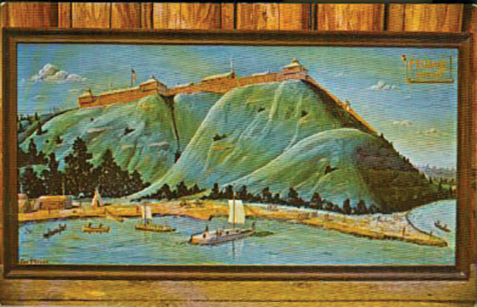
This week’s postcard is an early Chrome-type postcard published by James Tetrick of Kansas City showing historic Fort Osage near Sibley.
On June 23, William Clark wrote in his Corps of Discovery journal that: “The wind was against us this morning … were obliged to lie-to during the day at a small island. Directly opposite, on the south, is a high commanding position, more than 70 feet above the high water mark, and overlooking the river. This spot has many advantages for a fort and trading house with the Indians.”
The high hill, which was later known as the “place of the big eddy,” overlooked the Missouri River and was seen as a highly advantageous location for a new fort and trading outpost to establish contact with the local Indian tribes.
Four years later, with a commission from then-President Thomas Jefferson, Clark returned to the site and founded Fort Osage — named for the indigenous tribes of Little Osage and Great Osage Indians.
The outpost was strategically established to secure the friendship of the powerful Osage nation and to establish a presence in the new Louisiana Territory.
George Sibley was commissioned as the new Factor to lead the fort, overseeing the daily trade operations with the Indians at the time. Sibley was the son of a Revolutionary War physician John Sibley.
In 1816, after eight years at the fort, he married Mary Easton, the daughter of a wealthy St. Louis banking magnate. The new Mrs. Sibley led the posh life even on the edge of the wilderness. Following the wedding, she had a literal flotilla of keelboats filled with household goods shipped to the fort, along with her younger sister and an entourage of servants and housekeepers.
Despite its success, Fort Osage was decommissioned in the early 1820s following Missouri’s admission to the Union.
During its time, the fort was the hub of activity for the entire region, housing as many as 100 people plus a military detachment around the fort. Large Indian encampments were established around the fort to trade with the tribes of the region. Roughly 120 years later in the 1940s, preservationists petitioned the government of Jackson County and the state of Missouri for funds to rebuild the fort and establish a historic presence on the high hill overlooking the river. The area was excavated and the original foundations of a few of the buildings were located and plotted.
Today’s restored and rebuilt Fort Osage is roughly 30 percent of the size of the original fort. Currently, the landmmark is closed to the public after a grass fore on February 18 damaged three buildings and a fence on the site.