By MICHAEL BUSHNELL
Northeast News
December 12, 2012
Karnes Boulevard meanders through the Coleman Highlands, Volker neighborhoods and Roanoke Park, between Southwest Trafficway and 31st Street, and southwest to roughly 37th Street where it intersects with Roanoke Road and Wyoming Avenue.
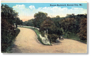
The view on this hand-colored postcard published in 1911 by Hall Bros. of Kansas City, Mo., shows the intersection of Roanoke Road and Karnes Boulevard, one of the beautifully landscaped entrances to Roanoke Park.
Roanoke Park, officially dedicated in 1908, is a roughly 36-acre preserve of rugged cliffs and forested ravines in an area punctuated by the elegant homes built along the shaded boulevards and roads that made Kansas City a showcase of the City Beautiful movement, popular during the early years of the 20th Century. Along a steep hillside just east of the tennis courts was the Roanoke Park Cave, long thought to be a hideout of the outlaw Jesse James. According to residents who lived in the area during the 1940s, the cave was a narrow slit up a rocky outcropping in the park. Legend has it that sometime in the early to mid-1940s, two children got lost in the cave and died as a result. Soon after that, the entrance of the cave was sealed by the Parks Department.
Land for the park was acquired between 1901 and 1923. The first two tracts were donated to the city by the South Highland Land and Improvement Company. Other parts of the park were given by local individuals. As Kansas City’s wealth began to move away from Northeast and Quality Hill, the area was developed into upscale housing occupied by prominent Kansas Citians. As the area developed, land adjacent to the residential district was purchased by the residents and donated to the city for the park, the primary interests being keeping undesirable growth away, thus keeping property values protected.
A 1914 Parks System report from the city describes the park as follows:
“This park is a beautiful preservation of wooded ravines lined with rugged cliffs, in the western section of the city. It was entirely acquired by deeds of gift from the South Highlands Land and Improvement Company and others, who had caught the spirit of conserving nature’s beauty before it became marred, and of the resulting enhancement in value of nearby property.”
Just east of the park, Kansas City’s International Fair was located between Valentine Road and 38th Street in the area now bisected by Southwest Trafficway. The fair opened on Sept. 17, 1883, and featured horse racing, livestock shows and various other fair type events. The fair was a huge success, drawing upwards of 25,000 people in 1886. The next year, the land was purchased by the Roanoke Development Company and the fair moved to an open area near 15th Street and Prospect Avenue.