By Paul Thompson
Northeast News
July 13, 2016
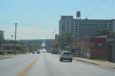
KANSAS CITY, Missouri – The proposed Independence Corridor Overlay district is now one step away from becoming a reality.
The community-backed, 3.5 mile overlay district earned the unanimous approval of the Planning, Zoning, and Economic Development committee on Wednesday, July 13, meaning that the re-zoning initiative is now only a vote from the full city council away from becoming an ordinance. 3rd District Councilman Quinton Lucas made the proposal to move the committee sub forward with a recommendation of do pass; 4th District Councilwoman Katheryn Shields and 5th District Councilman Lee Barnes Jr. voted in favor. Remaining committee members Heather Hall (1st District) and Scott Taylor (6th district) were absent from the committee meeting.
If eventually passed by the full council, some uses along the Independence Avenue Overlay corridor would be prohibited from future development, including group living, single-family, adult businesses, employment agencies, pawn shops, gasoline and fuel services, motor vehicle sales, and vehicle storage and towing, among others. The proposal also calls for the district to be split up into three separate zoning groups.
“There are different regulations that come into play for each area,” explained Ashley Winchell of the City Planning and Development office.
According to Winchell, Area A (Forest to Benton; Paseo from Independence to 8th; Prospect from Independence to 8th) has most the historic buildings and the fewest vacant buildings; Area B (Benton to Topping) has more buildings with setbacks and more opportunity for development; Area C (Topping to Ewing) has the most structures in need of repair.
The overlay district had previously been unanimously approved by the City Plan Commission on Tuesday, June 7. After that meeting, Plan Commission member and Independence Avenue CID President Bobbi Baker-Hughes touted the importance of the new zoning regulations surrounding the Independence Avenue corridor.
“The future development of Independence Avenue requires developed guidelines, and that those guidelines are developed to ascertain the look and the feel of the urban community that we drive to be,” said Baker-Hughes on June 7. “Without those guidelines, we are just not going to build for the future.”
The goal of the Independence Corridor Overlay is to create regulations requiring high-quality building designs that emphasize pedestrian traffic along the corridor. City staff held at least 10 community meetings to gather input about the Independence Corridor Overlay proposal in advance of the Plan Commission hearing, while also mailing roughly 1,400 letters to those affected by the proposed new zoning regulations.
As reported by the Northeast News in June, the area of the proposed overlay district includes 156 acres along the Independence Avenue corridor. Current zoning includes medium-high density residential, commercial, and light industrial uses, but the majority of the uses in the area are commercial.
The overlay district plan considers the replacement of the Independence Avenue East Special Review District and the Independence Avenue West Special Review District with the new special character overlay district. Those special review districts were instituted in 1998, and are considered less strict than the regulations within the Zoning and Development code adopted in 2011. If approved by the council, the overlay district would create alternative development and zoning goals for the Independence Avenue corridor that would regulate lot and building standards, architectural materials, facade articulation and composition, building transparency, parking and loading, screening, fencing and walls, and signage.
After hearing the presentation from City Planning and Development staff, Councilman Quinton Lucas noted that in his estimation, the Northeast community has largely come down in favor of the proposed zoning adjustments along Independence Avenue.
“I certainly think that there are a lot of folks excited by these different standards,” Lucas said.
Detached single-family homes would not be allowed in the proposed overlay district, and all other residential housing along the corridor would be required to be at least two stories tall, with a maximum height of 45 feet. All residential buildings with three or more units would be required to provide outdoor spaces for tenants. Regulations would also mandate at least one of the following: a porch with a minimum depth of six feet, spanning 50% of the front façade; a balcony with a minimum depth of four feet and a minimum width of six feet; or a stoop (minimum three per structure) with ornamental rails and cheek walls not exceeding one foot in height.
Architectural materials used in construction along the corridor would be regulated by the new overlay district. Primary materials allowed on the front and street-side portions of structures built under the zoning guidelines include brick, stone, cast stone, glass, and terra cotta. Some materials are not permitted at all. Those include concrete masonry unit, split faced block, glass block, and exterior insulation and finishing system (EIFS).
Signage of new buildings under the overlay district would be permitted to have one wall sign, one awning, canopy, or marquee sign, and one projecting sign per tenant with a customer entrance. Monument signs are allowed for certain uses, although they cannot be more than 20 square feet in area or four feet tall. Hand-painted signs will be permitted, but they would not be allowed to face Independence Avenue. Hand-painted signs would be permitted to cover up to 50% of the façade area.
The new overlay district would not supersede historic overlay districts such as Pendleton Heights and Scarritt Point, which means that the historic zoning requirements of those districts would still maintain priority. If a historic overlay is silent on a particular standard, then the regulations of the proposed Independence Corridor Overlay would apply. If that is also silent on the standard, then regulation would come from the Zoning and Development Code.