By Michael Bushnell
Northeast News
June 15, 2016
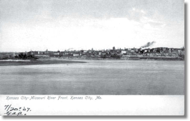
Kansas City’s riverfront on the Missouri River is pictured in this old, turn-of-the-century postcard published by The Southwest News Company of Kansas City.
In the mid-1800s, Missouri River steamboat passengers who were California-bound disembarked at the great bend in the river and continued their westward journey by wagon train. Some pioneers abandoned plans for the arduous overland trip and settled in the town of Kansas. Upriver, between what is now Riverside and Parkville, is the site of old Fort Quindaro.
Today, little is known or remains of the town named for Quindaro Brown, a Wyandot Indian maid of royal blood, who became Mrs. Abelard Guthrie (Guthrie was a member of the original town company of Quindaro). The town, surveyed by O.A. Bassett, was bounded on the north by the Missouri River and extended far enough back to average about three-fourths of a mile in width.
This card pictures the skyline of downtown Kansas City circa 1908. In the far left of the picture is the Hannibal Bridge. It was built in 1869 and was the first railroad bridge across the Missouri River. In the center of the picture, the Board of Trade building can be seen, as well. The photo was taken from the point where the Kansas and Missouri rivers connect. A large rock bearing the names of Lewis and Clark marks the spot today. (Getting to it is another story, as it is fenced off by the Kansas City Water Works plant!)